Pages

Thursday, 30 August 2018

North Queensland

After a few days in the Atherton Tablelands, we headed for the coast and began our long journey south to Melbourne for the ferry across Bass Strait, and home. First port-of-call was Rollingstone, 40 kms north of Townsville, voted Queensland’s favourite caravan park. It’s certainly one of ours, as we spent a good deal of time there last year, and it made such an impression on us that we stayed again a year later. This time, however, we noticed an alarming difference that was again due to the influence of climate. The beautiful Rollingstone beachfront had been eroded by an encroaching shoreline. The park was smaller by about a metre along its eastern boundary. Strategically placed sand bags were slowing the process, but seemed so futile. It was quite alarming.
The eroded beachfront of Rollingstone Caravan Park.
The day we left Rollingstone, we received warnings of an out-of-control bushfire to the north. Fortunately we were heading south, so we were in no danger, but we later met a couple who had a tense few hours as they travelled from the north through dense smoke towards Rollingstone. After we pulled into the coastal town of Bowen for a few days, there was some disturbing news on the radio – there had been three fatalities after a car and caravan collided with a petrol tanker just outside Bowen. We had passed that very spot only an hour before. Photographs of the scene were sobering, to say the least.

Bowen is an obvious favourite destination for retired travellers. We met several of them, many from Tasmania, who spend up to three months in Bowen each winter. It has several lovely beaches, with Horseshoe Bay being the best because it has small coral outcrops just off-shore, and the lack of any crocodile warning sign means that you can swim and snorkel there - a rarity in northern Queensland. Sadly however, the large amount of dead coral was evidence of storm damage and coral bleaching. On top of Flagstaff Hill on the outskirts of town was an interpretation centre that had been closed for over a year, after being badly damaged by Cyclone Debbie. It seems that climate change is haunting us throughout this trip. Drought, bushfires, coral bleaching, hurricanes, super high tides – all making their mark as we travelled through the outback to the sea.
Horseshoe Bay, Bowen. Somewhere out in the bay is a whale.
Continuing south, we left the coast at Rockhampton and headed for the Newell Highway, which would be the quickest route through NSW to Canberra. This meant that we had to drive through the lovely little town of Mt Morgan, just outside Rockhampton, and we couldn’t do so without stopping at another favourite little caravan park from last year. The owners of Silver Wattle had changed from Mark and Sarah to Dave and Deb, but the hospitality and friendliness had not. It was a charming few days, but with only three weeks until our boat sails from Melbourne, we had to concentrate on heading home.
Mt Morgan.

Wednesday, 15 August 2018

Farewell to the Outback

The Savannah Way is the road across the top of Australia. It runs east-west from Cairns to Broome and gets its name from the countryside around the Gulf of Carpentaria, termed Gulf Savannah. Everything is brown or dusty coloured - rocky, sandy, flat land with trees no more than two metres high. We joined the Savannah Way at Mt Isa and followed it east, although at Normanton it takes a detour north to Karumba (as we also did). After our week in Karumba, we continued east through the savannah towns of Croydon, Georgetown and Mt Surprise. As well as caravan parks and free-camps (where our solar panels provided all the power we needed – there’s no end of sunshine up here), we stayed on a farm called Pinnarendi near the Undara National Park, about 200 kms west of Cairns. The farm owners have set up a little side-business offering camp sites to caravans, and it was a delightful place to spend a few days, surrounded by nothing but bush.

Undara was only recently designated a National Park because of its unique past, which involved some substantial volcanic activity. About 190,000 years ago, a series of eruptions sent lava flowing down creeks leading from the volcano. These rivers of molten rock solidified on the surface while continuing to flow beneath. Today those streams of lava have turned into gigantic tubes in the rock that criss-cross the Undara plains that are dotted with extinct volcano craters. Some of these lava tubes have revealed themselves by collapsing inwards, allowing them to be explored by thousands of tourists, and would-be geologists, like us. It was a fascinating day’s exploration.

Heading still further east, we entered the Atherton Tablelands and the countryside quickly changed. The height of trees increased from two to ten metres, the grass went from lifeless brown to vibrant green, the flat horizon disappeared into rolling hills, and the road was anything but straight. More importantly, the land is taken up with crops of all shapes, sizes and colours. Green should never be taken for granted. The total absence of it over the past month has made us miss Tasmania.

Leaving behind the outback, it has left several lasting impressions on us - a total lack of water, clouds, green grass and tall trees, but an abundance of sunshine, roadkill, caravans, straight roads, and immense road trains over 50 metres long. And as if kangaroo, wallaby and emu weren’t enough, cattle roamed across the road from unfenced farmland. Carnivorous hawks and kites feed on roadkill, and their soaring presence is visible from many kilometres away. Caravans and motorhomes dominate the oncoming traffic. Grey nomads must be a huge portion of the travelling public.

Water, or lack of it, is the key. The hot topic in the national news at the moment is drought relief for farmers in western New South Wales and Queensland. The Federal Government has given several million dollars, and even Tasmanian farmers have donated stock feed that the Spirit of Tasmania will transport across Bass Strait at no cost. Seeing this drought first-hand, we can understand the dire consequence of it not raining. It is depressing to see.

Friday, 10 August 2018

Karumba, north Queensland

Karumba is indeed true to its slogan - “the outback by the sea”. Through Normanton and on the approach to the town there are vast expanses of salt and flood plains with low scrub and small trees. Quite simply dry and dusty. Arriving in Karumba, the sea greets you with a relieving cool breeze and relaxing panorama of the Gulf. Monsoonal rains brings floods every year, which is difficult to imagine in this dry and dusty place, but the tourist season goes into recess between November and March as the rains come tumbling down.
Anne, Murray and Estelle, looking out over the Gulf.
Karumba sits on the mouth of the Norman River as it enters the Gulf of Carpentaria. Mangroves dominate the river’s edge upstream for hundreds of kilometres, which in turn provides a home for crocodiles. We did a boat tour one evening and saw crocs lying at the water’s edge, one of them was massive in size. It looked large enough to swallow a human in one go. We also saw jabiru, long-legged waterbirds, actually Australian storks, and the females have  mysterious yellow eyes. Various birds of prey, eagles, sea eagles and kites, soared above our boat with magnificent wingspans. The boat then took us out into the Gulf to watch the sun sink into the sea in front of us. A memorable evening. One of many.
A female jabiru, on the Norman River.
A monster crocodile, scary even from a distance.
Karumba is one of very few places that access the Gulf of Carpentaria, although you cannot swim in the bright blue waters due to the threat of being taken by a crocodile. This area is also famous for fishing, indeed we felt out of place for not having a tinny dinghy on the roof of the car, as most other visitors did. Fishing has been so popular that a few years ago it was recognised that the local delicacy, barramundi was threatened by overfishing, so a hatchery program was developed. We toured a local hatchery where barramundi are reared in tanks from eggs and released into local waterways to ensure the future of the species.
Barramundi, after hatching in captivity, they await release into the wild. 
The sun setting in the west seemed to put on a show for us every night in the outback. The bar at the Sunset Hotel on Karumba Point is strategically placed to provide a dramatic view of nightly sunsets. The sun appears to dip into the sea, releasing an eerie red glow across the horizon. The darkness then reveals an uncanny row of flashing red and green lights atop channel markers that guide boats out into the Gulf. It is certainly a famous place to have a beer and experience the outback by the sea.
The Gulf sunset, from the bar of the Sunset Hotel, Karumba Point. 

Sunday, 5 August 2018

Karumba, north Queensland

Mission accomplished. When we left Melbourne six weeks ago, the aim was to make Karumba on the Gulf of Carpentaria, and we have arrived. It’s so nice to see a large body of water stretching out before us, as the past few weeks have been nothing but dry, dusty, barren, rocky and tree-less landscapes. We are camped on the edge of the wide Norman River which empties into the great Gulf, and the expanse of water is beautiful. The national news is reporting of financial assistance from the Federal Government to drought-stricken farmers up this way, and we have seen why they’d need it. Major towns rely on water storage dams, large enough to be called lakes, but farmers are struggling to feed their stock on the pitiful amount of grass that tries to grow. The problem hits home when you see it first-hand.

On the way here, we explored Mt Isa, one of those rare single-employer towns. It has achieved “city” status with a population of 20,000 and the vast majority of people work for the mine operators Glencore. With a mixture of underground and open-cut, it is the world’s largest single producer of copper, silver, lead and zinc, and the mine’s footprint takes up half of the city. At night the mine has more lights than the rest of the town. All of the facilities you need are here – swimming pool, schools, library, pubs, sports grounds, parks, Bunnings – and we met locals who proudly said that they were born and bred in the Isa.
Underground hospital from WW2, Mt Isa.
Smaller towns along the way were no less interesting – Winton had the Waltzing Matilda museum, Mckinlay had the Walkabout Creek Hotel from the Crocodile Dundee movies, Cloncurry had the museum dedicated to Dr John Flynn and the Royal Flying Doctor Service. The roads in between each of them were startlingly the same - flat and straight. You’re easily fooled by the mirage of water in the shimmering sun as the road disappears at the vanishing point on the horizon. Paddocks by the roadside are almost alien - sandy, rocky plains covered in weird spikey ant mounds and the tallest “tree” is only two metres high, sitting solitary in the middle of an enormous open countryside. A phone tower becomes visible from thirty kilometres away. There is not a cloud in the sky, living up to the Queensland moniker as “The Sunshine State”.

The road from Cloncurry to Mt Isa provided a welcome change, as red rocky outcrops and large eucalypts interrupted the bleak terrain. At one point we pulled into a rest area, and a familiar sound greeted us as I turned off the car engine. From the trees overhead emanated bird song, distinctly budgerigars. Having an aviary full of them back home, we were very aware of that sound, and it was music to our ears. The flock of several dozen budgies flew over us and it was lovely to see them in the wild and enjoying their freedom.
Budgies, in the wild.
Karumba itself is a small village of a few shops, two pubs, four caravan parks and two boat ramps. Our caravan park is adjacent to one of those pubs, so the 30-degree days are being nicely hydrated. People come here to fish, so we are the odd ones out. We are camped next to Murray and Estelle so we have lovely company while we explore, but as with our entire journey, we’re surrounded by vehicles registered in every state of Australia. We will stay a few days and then head east to the coast, and the sea, and then head south for home.

Monday, 30 July 2018

Outback Queensland

What a contrast - leaving the beaches and crowds of Maroochydore for the desert and isolation of the Queensland outback, going from where every inch of real estate is at a premium to where land is abundant and of little value. Debate is fierce about the worth of seeing the outback. You’re either bored by the mundane and flat sparseness of the barren landscape and the complete lack of hills and forests, or fascinated by the different flora, fauna, people and way of life. Maybe if you lived out here you would not care for this scenery, but coming from the rolling greens hills of Tasmania, we found it fascinating.

Heading west away from the coast, we travelled through Kilcoy, Dalby, to Miles for an overnighter. Then on to Roma, and it was last year that we went through Roma from south to north, but this day it was east to west. Then through Muckadilla and Morven to Charleville to stay for a few days. Caravan parks out here all have a certain minimum standard – little shade, no grass and plenty of dust. Charleville had the Cosmos Centre, where you can learn about the stars in the beautifully dark outback night skies. I attended an evening session, and after being seated in a large shed on the outskirts of town, a magic button was pressed that separated the shed into two halves and the night sky was dramatically revealed as the roof overhead opened up. This night wasn’t a great night because of the near-full moon, but the telescopes still provided an incredible view of star clusters like Omega Centauri, and the Galilean moons of Jupiter, the rings of Saturn and the craters of the moon. For me, it was a fantastic time. While in Charleville, I also visited the studios of Indigenous community station 4RR and was interviewed on-air.
With Rob from 4RR FM, Charleville community radio.
Pushing northwards through Augathella, Tambo, Blackall, and Barcaldine that had The Tree of Knowledge, beneath which a group of shearers met in 1891 to strike and supposedly formed the beginnings of the Australian Labour Party. Then on to Longreach. Even before arriving at the outskirts of Longreach, the Qantas Museum announced itself by the sight of the gigantic tail fin of a real Boeing 747 parked in the grounds of the Longreach Airport. Its distinctive red colour adorned with the stylised flying kangaroo can be seen for vast distances, not only because of the surrounding land is so flat but also because of its height. It really is the tallest structure in the Longreach region. Walking beneath the huge jet was simply awesome, and we learned about each of the exterior instruments before touring the interior, including the flight deck. Next to it was a Boeing 707, an older vintage but nonetheless interesting. Now decommissioned, these planes will never fly again, and they gave us a thrilling time. Inside the museum were more exhibits from the history of Qantas, which started in Longreach just after the First World War, and interestingly one of its founders, Sir Hudson Fysh, was born at St Leonards in Launceston.
The Qantas Museum, Longreach.
Longreach also has the Stockman’s Hall of Fame that we did not get to see, but the caravan park had a restaurant with its own resident stockman-storyteller- singer, with his own gorgeous sheep-dog Henry and massive bull Ollie. He even let me join him on-stage for a song or two. By an amazing coincidence, we have met up with Launceston friends Murray and Estelle, who are also venturing up this way in their caravan. We will meet up with them later in Karumba on the Gulf of Carpentaria.
Anne saying "hello" to Henry the stock dog, Longreach.

Saturday, 21 July 2018

Sunshine Coast, Queensland

It’s been a while since I last posted. Blame a lazy ten days on the Sunshine Coast of Queensland while catching up with some mates from home.

When we crossed the border into Queensland, the landscape changed almost immediately. Forests became more dense, its foliage greener with broader leaves, and palm trees appeared. Everything became more colourful, such as birds and butterflies. In the towns, supermarket carparks provided awnings for shade, and houses were built on stilts. We drove through Toowoomba, the 2nd largest Queensland city after Brisbane, and 2nd largest inland Australian city after Canberra. We stayed a couple of days at the charming little town of Esk, population about half that of Tenterfield at two thousand people. Nearby were lakes Somerset and Wivenhoe that were created by dams to provide flood mitigation and water to Brisbane and surrounds, but had also created beautiful views and picnic areas. Picturesque was the adequate description. Then onto the multitudes of Maroochydore.
Lake Somerset, near Esk.

It was our first time on the Sunshine Coast, and we came away after ten days with a good insight into this burgeoning place. Not as “highrise” as the Gold Coast, but it won’t be long before it is. Dozens of cranes hovered over new buildings, and some of the structures had huge footprints. The thousands of businesses sold either accommodation, clothes, alcohol or food – and real estate. The beaches were certainly spectacular, as were the sunsets, so you could look out to sea while sipping your latte or wine before retiring to your million dollar apartment or cabin cruiser parked in the marina.

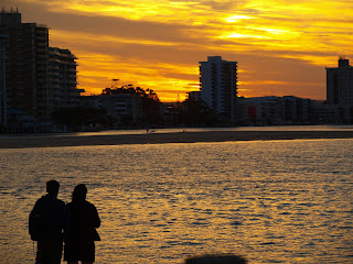
Sunset over Maroochydore.

Our caravan park (Cotton Tree at Maroochydore) had a large Tasmanian contingent, and three of them just happened to be our close mates from home, so a splendid time was guaranteed for all. We also caught up with Brisbane friends we met last year on the European cruise, and also a former workmate of Anne’s. Our park was packed, as were all the caravan parks up and down the coast. Some were there for the long haul – three months at a time, paying $50 a night. We’d heard about the winter mass exodus of southerners to these parts – it was quite extraordinary.
Our restaurant in the forest for our anniversary.

You don’t come here to get away from crowds. As well as people, there were lots of bikeways, shopping malls, parklands and multi-lane motorways. Surf clubs provided meals and poker machines while monitoring the beaches. Man-made canals brought private boats to the back door of some luxurious homes. We all went to a fabulous restaurant in the middle of the forest by a lake for our 39th wedding anniversary. We went to the famous Eumundi market, arriving early to beat the rush, and the carpark was already near-full. Many times larger than Hobart’s Salamanca market, thousands flock to this shopping treasure-trove twice a week. It was an eye-opener for us, as was the entire Sunshine Coast.

Sunday, 8 July 2018

Tenterfield, N.S.W

 The journey continued ever northwards, after returning to Rylstone to pick up the caravan. The decision to travel the hilly New England Highway instead of the much flatter Newell Highway was a good one, as the Bylong Valley’s majestic rusty-red cliffs towered above us. The Pajero hauled the caravan up some steep hills while we were in awe of the views. Rocky outcrops poked through some dense forests to reveal the underlying geology of the Goulburn River National Park. It was a long day’s drive through Muswellbrook, Scone and Tamworth before pulling up at the little town of Bendemeer for the night. The caravan park represented the town – small, simple and rural – but the meal at the pub was superb. An easier shorter day followed, as we reached the charming little city of Tenterfield for a two night stay in Barnaby Joyce territory.

This fascinating place demanded a day-long stopover to explore the tantalising story of a famous local resident immortalised in a very famous song. Everyone knows Peter Allen’s song “Tenterfield Saddler”, released in 1972, that tells the story of three generations of his family over three verses. The first verse was about Peter’s grandfather George Woolnough, after whom the title refers. We learned that the words in the first verse are indeed very true. George’s saddlery building is still there in High Street, and he ran his business, and sat on his verandah, for 52 years before retiring in 1960. As the song says  – “The late George Woolnough, worked in High Street – for 52 years, he sat on his verandah”. It remains open for anyone to walk through its three small rooms, filled with old leathering tools and sewing machines.
"For 52 years he sat on his verandah" - this verandah.
The second line mentions how George “lived on manners”, which I took to mean that he was a polite gentlemen. What it actually means is that while his shop was on High Street, he lived in his house on Manners Street, which was also where our caravan park was located. So George just lived down the road from where we stayed. In the middle of town is the library, and indeed it does have a new wing that was recently built and named as the George Woolnough Wing. As the song says - “He lived without sin, they’re building a library to him”.
The "George Woolnough Wing" of the  Tenterfield library.
I met an old fella in the town called Wayne, who was in his 70s and a bikie, and he went to school with Peter Allen and knew old George. He told me that the Tenterfield Saddler really was a thorough gentleman, always giving his time to have a yarn and help you out. Wayne felt let down by Peter’s song, saying that it just cashed in on George’s story for Peter’s financial gain. That may be true but that song has brought world-wide attention to this small Aussie rural town. By the way, the town will be holding a "Peter Allen Festival" in a few weeks.

I finished this journey by seeking, and finding, George’s final resting place at the Tenterfield cemetery, buried next to his wife. He died in 1963, only three years after retiring. He would never get to hear the music of his famous grandson.